
There is a particular shade of grey that the Highveld sky turns before a serious winter front moves in. It is not the soft, cotton-grey of summer rain. It is a hard, metallic grey—the colour of steel just before it snaps. On Tuesday morning, that colour stretched from the Magaliesberg to the Maluti mountains, and the South African Weather Service (SAWS) delivered a message that sent a shiver through the nation before a single drop of cold had fallen.
An intense cut-off low-pressure system—meteorologists’ jargon for a particularly unpredictable and dangerous weather pattern—is set to grip large parts of the country from Tuesday through Thursday, bringing with it very cold temperatures, gale-force winds, heavy mountain snow, and disruptive rainfall.
“This is not a routine winter cold front,” said senior SAWS forecaster Mbavhalelo Makhado in a live briefing from the service’s Pretoria headquarters. “A cut-off low is inherently unstable. It moves slowly, it intensifies rapidly, and it can produce weather extremes—heavy rain in one area, snow in another, and destructive winds in a third. We are urging all South Africans, from the coastline to the interior, to take this warning seriously.”
The Meteorological Breakdown
The system, which began forming over the southern Atlantic Ocean over the weekend, detached from the main westerly wind belt on Monday and is now spinning independently—hence “cut-off.” It is expected to make landfall over the Western Cape on Tuesday morning before tracking eastward across the Southern and Eastern Cape, then curving northward into the Free State and KwaZulu-Natal by Thursday.
The SAWS has issued a cascade of colour-coded warnings:
Orange Level 6 (high risk) warnings have been issued for the western and southern parts of the Eastern Cape, as well as the southern interior of KwaZulu-Natal, for disruptive rain leading to flooding of roads, bridges, and low-lying areas. Rainfall accumulations of 40–60mm are expected within 24 hours, with mountain areas possibly seeing up to 80mm.
Orange Level 5 warnings are in place for the Cape Winelands, Overberg, and Garden Route districts of the Western Cape for damaging winds gusting between 70–90km/h, with gusts exceeding 100km/h possible in exposed coastal areas.
Yellow Level 4 warnings for damaging winds and cold temperatures cover much of the Northern Cape, Free State, North West, and Gauteng, where wind chill factors could make temperatures feel as low as -5°C in open areas.
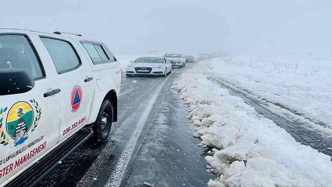
Yellow Level 2 warnings for snow have been issued for the high-lying areas of the Eastern Cape (including the Barkly Pass and Wapadsberg), the southern Drakensberg in KwaZulu-Natal, and the Lesotho border region, where accumulations of 5–10cm are expected, potentially closing mountain passes.
“We are looking at a significant multi-day event,” Makhado explained. “The system is slow-moving, which means communities could experience cold, wet, and windy conditions for 48 to 72 hours consecutively. That is a long time to be exposed to near-freezing temperatures, especially for vulnerable populations.”
The Coldest Corners
While much of the country will feel the bite, some areas are bracing for truly extreme conditions.
Sutherland, the Northern Cape town famously known as the coldest in South Africa, is forecast to see daytime highs of just 3°C on Wednesday, with overnight lows plunging to -8°C. With wind chill, it could feel like -12°C.
Molteno in the Eastern Cape, another traditional cold pole, is expected to see temperatures drop to -6°C, with snow likely on the surrounding hills.
Underberg and Himeville in KwaZulu-Natal, gateways to the southern Drakensberg, are under snow watches, with the Sani Pass—the highest road in South Africa—likely to be closed to all but 4×4 vehicles with chains.
Even Johannesburg and Pretoria, which often dodge the worst of winter fronts, will see maximum temperatures struggling to reach 14°C on Wednesday and Thursday, with overnight lows of 4°C and 5°C respectively. Combined with strong winds, the “feels like” temperature could dip below freezing in the early mornings.
Cape Town will escape the extreme cold but will bear the brunt of the wind, with gusts expected to howl through the city on Tuesday afternoon and evening, potentially knocking down trees and power lines in informal settlements.
Human Impact: The Vulnerable and the Prepared
Behind the meteorological statistics lie real human beings—some who will huddle around heaters in brick houses, and others who will shiver under cardboard and plastic sheeting.
In the informal settlements of Khayelitsha and Dunoon on the Cape Flats, residents spent Monday reinforcing their shacks, tying down corrugated iron roofs with wire and old tyre strips.
“We have seen these winds before,” said Andile Mfene, 34, a resident of Kosovo informal settlement in Philippi. “Last year, the wind took my entire roof. It flew away like a piece of paper. My children slept in the rain. This time, I have put car tyres on top. I am praying it holds.”
In the Eastern Cape’s rural interior, farmers are scrambling to move livestock to sheltered kraals and to cover vulnerable newborn lambs and calves. The cold front comes at the tail end of the lambing season, and a sudden temperature drop can be fatal for animals not yet strong enough to regulate their body heat.
“We have already lost three lambs this week to the cold,” said farmer Pieter van Wyk, speaking from his property outside Molteno. “If the temperatures drop as low as they are predicting, we could lose dozens more. You cannot build a barn for every sheep on a 5,000-hectare farm. You just pray and you prepare.”
Urban informal settlements face a different but equally dangerous threat: fire. As temperatures drop, residents without electricity resort to paraffin stoves, candles, and illegal electrical connections to stay warm. These are the same conditions that produce the devastating winter shack fires that kill dozens of people every year.
“Every winter, we have the same conversation,” said Dr. Inge Petersen, a disaster management specialist at the University of KwaZulu-Natal. “We warn people not to leave paraffin stoves unattended. We warn against using damp kindling that produces toxic smoke. But when you are cold and you have no alternatives, you take risks. The cold front itself may not kill people directly. But the fires it indirectly causes will.”
Infrastructure Under Pressure
The SA Weather Service has coordinated with Eskom, SANRAL (the national roads agency), and provincial disaster management centres to prepare for the system’s impact.
Eskom has placed emergency response teams on standby in the Eastern Cape, Western Cape, and KwaZulu-Natal, where strong winds and wet snow could bring down power lines. “We have pre-positioned repair crews and equipment in strategic locations,” said Eskom spokesperson Daphne Mokoena. “However, customers should prepare for the possibility of outages. If winds exceed 80km/h, we may not be able to send technicians up in bucket trucks until conditions improve.”
SANRAL has warned motorists to avoid mountain passes in the Eastern Cape and KwaZulu-Natal during the height of the system. “Passes such as Naudésnek, Wapadsberg, Barkly Pass, and Sani Pass could become impassable or extremely dangerous,” said SANRAL’s Vusi Mabena. “If you do not absolutely need to travel, do not travel. If you must travel, carry warm clothing, blankets, water, and emergency contact numbers.”
The City of Cape Town’s disaster management centre has activated its winter-readiness plan, including the opening of temporary shelters for homeless residents in the CBD, Bellville, and Mitchells Plain.
“We have capacity for approximately 500 people across our shelters,” said Mayoral Committee Member for Community Services and Health, Councillor Patricia van der Ross. “If demand exceeds capacity, we will work with NGO partners to find additional space. No one should have to sleep on the street in the conditions forecast for this week.”
Farmers and Agriculture
The agricultural sector, already reeling from a difficult summer season marked by erratic rainfall, is bracing for further losses.
The deciduous fruit industry in the Ceres and Grabouw regions of the Western Cape is vulnerable to hail, which can form within cut-off low systems. Apple, pear, and stone fruit crops that are still on the trees could be damaged, affecting export quality.
“We are monitoring the situation hour by hour,” said Anton Rabe, executive director of the Hortgro fruit growers’ association. “Some farmers have deployed hail netting, but not everyone can afford that infrastructure. We are hoping the system stays cold without producing hail. Cold is manageable for fruit. Hail is a disaster.”
In the grain-producing regions of the Free State and North West, the cold front is arriving too late to damage crops, which have already been harvested. However, livestock farmers in those provinces are still vulnerable.
“Cattle lose condition in extreme cold,” said Dawie Maree, head of agricultural information at FNB. “They burn energy just staying warm. If farmers have not provided adequate shelter or supplementary feed, they could see weight loss that affects their sale prices in the coming months.”
A Wake-Up Call for Climate Adaptation
While cut-off low systems are not new to South Africa, climate scientists have noted an increase in their frequency and intensity over the past decade.
“We cannot say any single weather event is caused by climate change,” said Dr. Sarah Roffe, a climatologist at the University of the Witwatersrand. “But the pattern is consistent with what models predict for a warming world: more extreme, more erratic, and more prolonged weather events. Cut-off lows are notoriously difficult to predict more than 48 hours in advance. That makes disaster preparedness challenging.”
The SA Weather Service has faced criticism in the past for underestimating or late-warning major weather events, including the 2022 KwaZulu-Natal floods that killed over 400 people. On Tuesday, Makhado acknowledged those concerns and urged the public to treat the current warnings with “extreme seriousness.”
“We have learned from past events,” he said. “We are issuing these warnings early, we are updating them regularly, and we are coordinating with disaster management authorities at all levels. Our message is simple: do not underestimate this system. It has the potential to cause significant disruption and, in some areas, danger to life.”
Preparation Advice for Residents
The SA Weather Service and disaster management authorities have issued the following advice for residents in affected areas:
For homeowners:
Secure loose objects in gardens and on balconies, including patio furniture, bins, and plant pots.
Check roof tiles and corrugated iron sheets for weakness.
Keep gutters and drainage systems clear to prevent flooding.
For motorists:
Avoid travel if possible. If you must drive, reduce speed and increase following distance.
Carry an emergency kit: blankets, water, non-perishable snacks, a torch, and a fully charged phone.
Be especially cautious on bridges, exposed roads, and mountain passes.
For vulnerable individuals (elderly, children, those with chronic illnesses):
Keep medications accessible.
Have a backup heating source in case of power outage (gas heater with proper ventilation).
Check on neighbours, especially those living alone.
For informal settlement residents:
Reinforce roof sheeting with tyres, sandbags, or heavy objects.
Do not leave paraffin stoves or candles unattended.
Keep a bucket of sand or water nearby for fire emergencies.
For pet and livestock owners:
Bring pets indoors or provide sheltered, dry spaces.
Move livestock to enclosed kraals with windbreaks.
Provide extra feed, as animals burn more calories in cold weather.
The Forecast Beyond Thursday
The cut-off low is expected to begin weakening on Friday, moving eastward into the Indian Ocean and dragging colder air behind it. The weekend is forecast to be dry but still cold, with daytime highs in the interior struggling to reach 16–18°C.
By Sunday, a gradual warming trend is expected, with temperatures returning to seasonal norms by the middle of next week.
But for the three days beginning Tuesday, South Africans are being asked to hunker down, to look out for one another, and to respect the unpredictable power of a cut-off low.
A Final Word
As the first icy tendrils of the front began to creep over the Western Cape coastline on Tuesday morning, Cape Town resident and retired teacher Margaret Cloete, 72, stood at her window in Muizenberg, watching the sea turn from turquoise to gunmetal grey.
“I have lived through many winters here,” she said softly. “But when the Weather Service uses words like ‘cut-off low’ and ‘orange level six’, you pay attention. I have my wood stacked. I have my gas bottle full. And I have already called my daughter to tell her I love her. That is what you do when the sky goes that colour.”
The sky, indeed, had turned that colour—the hard, metallic grey of a nation holding its breath, waiting for the storm to arrive.
South Africa, stay warm. Stay safe. And stay inside if you can.