
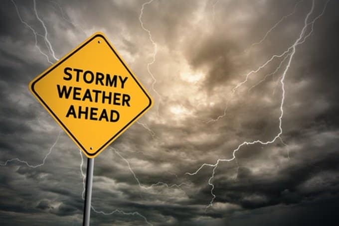
The Garden Route is, in fair weather, a postcard come to life. Its lush coastal forests tumble down to lagoons of improbable blue, and its passes carve through mountains that seem to touch a softer, kinder sky. Travelers come from across the world to hike its trails, kayak its estuaries, and sleep beneath its ancient yellowwoods. But paradise has a violent temper. And from Wednesday, 5 May, through to Thursday, 7 May 2026, that temper is expected to unleash itself in full fury.
SANParks, the managing authority of the Garden Route National Park, has issued a urgent caution to residents, tourists, and outdoor enthusiasts: remain on high alert. The South African Weather Service has elevated its warning to Orange Level 8—a rare and serious classification indicating “widespread and disruptive rainfall” with the potential for “significant flooding, infrastructure damage, and danger to life.”
Forecasters are predicting accumulated rainfall totals of between 100 and 200 millimetres over the 48-hour period, with localized amounts potentially exceeding that in areas where orographic lift—the phenomenon of moist air being forced upward by mountains—enhances the precipitation. For context, Knysna typically receives approximately 60 to 80 millimetres of rain in the entire month of May. It may now receive double that in two days.
“These are not normal autumn rains,” said SANParks spokesperson Lauren Howard-Clayton in a video briefing streamed from the park’s headquarters. “This is a significant weather event. We are asking everyone within the park boundaries—campers, hikers, day visitors, and residents—to treat this warning with the utmost seriousness.”
The Park’s Vulnerable Geography
The Garden Route National Park is a sprawling mosaic of ecosystems, stretching from Wilderness in the west to Nature’s Valley in the east, and encompassing the iconic Knysna Lagoon, the Tsitsikamma coastline, and the dense, misty forests of the interior. Its beauty is also its vulnerability.
The park’s topography is defined by steep slopes, narrow river valleys, and impermeable sandstone and shale bedrock. When heavy rain falls, water does not soak gently into the ground. Instead, it runs off rapidly, funneling into streams that become torrents within hours. The park’s famous trails—including portions of the Otter Trail and the Tsitsikamma Trail—cross dozens of these streams, many of which have no bridges, only stepping stones or seasonal low-water crossings.
“The Otter Trail is world-class, but it was not designed for a 100-year flood event,” explained veteran field ranger Hendrik Bothma, who has worked in the park for 22 years. “The river crossings that are ankle-deep on a normal day become death traps when the catchment has received 200 millimetres of rain. We have had to rescue hikers in the past. We are praying we do not have to do so again.”
SANParks has confirmed that all overnight hiking trails will be closed effective immediately, and day visitors are strongly discouraged from entering forested or riverside areas. Campsites along the water’s edge—including popular spots like Diepwalle and Bergplaas—have been evacuated, with rangers going door-to-door (or tent-to-tent) to ensure compliance.
The Lagoon and the Tides
The Knysna Lagoon, a protected estuarine system that is the jewel of the park, faces a particular and perilous risk. The heavy rainfall will send a surge of fresh water rushing into the lagoon from the Salt, Knysna, and Bitou rivers. Normally, this outflow would be balanced by the ebb and flow of the tides through the narrow Knysna Heads—the treacherous sandstone cliffs that guard the entrance to the ocean.
But the timing of the weather system is deeply unfortunate. The combination of high spring tides and storm-driven swells could create a “stacked” event where the ocean pushes in faster than the river can push out, causing the lagoon level to rise dramatically. Low-lying properties in Knysna’s waterfront areas—including the popular Thesen Island and Leisure Isle—have been placed on pre-evacuation notice.
“We are monitoring the lagoon levels every hour,” said Dr. Lara van Niekerk, a coastal estuarine scientist advising SANParks. “If the water rises above 1.8 metres above chart datum, we will issue a mandatory evacuation order. At that point, roads become impassable and flooding of ground-floor properties is inevitable.”
The Shadow of 2023
For long-time residents of the Garden Route, the warnings evoke painful memories. In September 2023, a similar cut-off low pressure system dumped more than 250 millimetres of rain on the region over three days, triggering landslides that closed the N2 highway for a week, washing away several bridges, and claiming the lives of four people in the small town of Botrivier.
The 2023 floods caused an estimated R500 million in damage to roads, public infrastructure, and private property. Recovery took months. Some hiking trails in the park remained closed for over a year due to washouts and unstable slopes.
“We learned hard lessons in 2023,” Howard-Clayton admitted. “One of them was that we cannot rely on historical rainfall patterns to predict future events. Climate change is making these extreme weather events more frequent and more intense. The ‘100-year flood’ now happens every few years.”
Safety Measures and Closures
In response to the Orange Level 8 warning, SANParks has implemented the following measures across the Garden Route National Park:
- All overnight hiking trails are closed until further notice. This includes the Otter Trail, Tsitsikamma Trail, and the shorter overnight loops in the Wilderness section. Registered hikers will receive full refunds or the option to reschedule.
- All day trails that involve river crossings are closed. This includes popular routes like the Waterfall Trail in Knysna and the Circles in the Forest trail. Only elevated trails that remain entirely above floodplains—such as the King Edward VII Trail—may remain open, subject to ranger discretion.
- All campsites and rest camps in low-lying areas have been evacuated. Guests have been relocated to higher ground or offered alternative accommodation outside the park.
- The Storms River Mouth area, including the suspension bridge, will be closed to the public from Tuesday evening through Thursday. The bridge, famous for its dramatic views, becomes extremely dangerous in high winds and heavy rain.
- Visitors are urged to delay all non-essential travel to the park until the weather system has passed and damage assessments are complete.
SANParks has also activated its emergency coordination center, which will operate 24 hours a day until the alert is downgraded. Rangers have been issued satellite phones to maintain communication in areas where cell towers may fail.
Advice for Stranded Visitors
For visitors already in the park or planning to arrive during the warning period, SANParks has issued clear guidance:
“If you are already in the park and the weather deteriorates, do not attempt to drive through flooded roads,” Howard-Clayton said. “Stop, turn around, and find higher ground. A vehicle can be swept away in as little as 30 centimetres of moving water. Do not underestimate the power of floodwater.”
The park has designated several emergency refuges—buildings on high ground that are stocked with basic supplies, blankets, and first aid equipment. These include the Storms River rest camp reception building, the Knysna park office, and the Ebb and Flow rest camp in Wilderness (the latter, ironically, named for the very tides that now pose a threat).
Communities on Edge
Beyond the park boundaries, the broader Garden Route community is also bracing. Municipal disaster management teams in Knysna, Bitou, George, and Mossel Bay have been placed on standby. Sandbags are being distributed at local fire stations. And in the informal settlements that fringe the towns—areas with inadequate stormwater drainage and homes built on unstable slopes—community leaders are going door-to-door urging residents to be ready to evacuate at a moment’s notice.
“We have seen what happens when the rain comes and the ground gives way,” said Nontando Mbeki, a community organizer in Knysna’s Hornlee township. “People lose everything. Their homes, their furniture, their documents. We are telling people to pack a bag now—clothes, medicines, important papers—and keep it by the door.”
A Glimmer of Hope
The forecast, however severe, is not without nuance. The heaviest rainfall is expected overnight Tuesday into Wednesday, with a gradual decrease late Thursday. Friday is currently forecast to be dry, with clearing skies and cooler temperatures returning over the weekend. If the system behaves as predicted, the floodwaters will recede relatively quickly, and the park could begin a phased reopening by early next week.
But for the 72 hours between now and then, the Garden Route will be a place of holding breath and watching skies. The yellowwood trees will sway in winds that have not yet arrived. The lagoon will darken as sediment rises. And the rangers—the men and women who know every trail, every stream, every hidden hollow of this magnificent park—will do what they have always done: prepare for the worst, hope for the best, and stand ready to pull people from the water if the water decides to take them.
“As a ranger, you learn to love the rain,” said Bothma, adjusting his wide-brimmed hat as the first fat droplets began to fall. “But you also learn to fear it. There’s a difference between the rain that makes the forest sing and the rain that makes the forest scream.”
He looked toward the hills, already disappearing behind a curtain of grey. “This one is going to scream.”